Topics
GeographyHeadlinesInfrastructureKatrinaNeighborhoodsPeopleRecreation
|
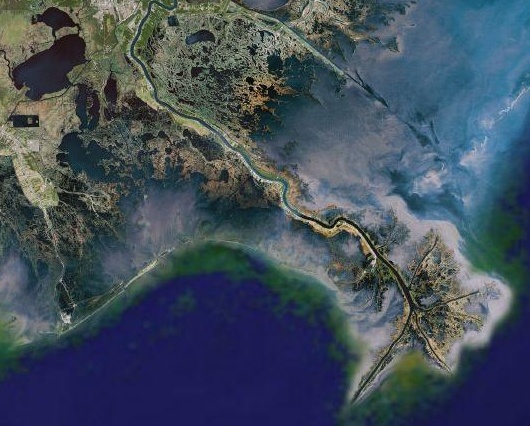
Over the past 285 years and particularly since 1900 the river has been under tight control. Levees, diversions, channel engineering, jetties and even more levees all the way to the head of passes near the mouth of the river have prevented flooding.
The last flood that got loose in New Orleans occurred in 1849. Even the infamous 1927 "Great Flood" which did so much damage in Mississippi was diverted across St. Bernard Parish and away from the city. The silt that would have restored the wetlands around the city for the past 150 years has instead created a bird's foot delta far out in the Gulf. Now the silt and fresh water needed to restore the wetlands are pouring over the edge of the continental shelf into 3,500 to 10,000 foot abyssal depths where they do no good.
Deprived of silt and exposed to high salinity, the land outside the levees is crumbling. The satellite image shows it clearly. Like no other delta in the world, the Mississippi River delta is breaking down. Its rotting lace, spider web appearance is indicative of the ongoing damage.
|